
Digital Signs in the Map of Mexico 1550
Author:
Acuña, Blanca, Díaz, Lily
Language:
English
Year:
2010
published at:
Abstract:
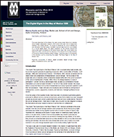
This paper describes the first phase of an open access project that aims to develop into a broader collaboration research effort within CoPs and CoIs of researchers working in the cultural domain. The project is framed by the use of ImaNote, an open annotation tool that makes it possible to access high-resolution visual details on a cultural digital object. The paper comments on the process followed for creating the digital annotations on the cultural digital object, the context behind the ‘hypertextual form’ created, and the relevance of the research for the dissemination of scholarship of Mesoamerican cultural heritage. It also illustrates the functionality of the interface used by presenting the project ‘The Digital-Signs in the Map of Mexico 1550’.
Link:
Mapa de México 1550: aprovechamiento de las nuevas tecnologías para proteger y difundir el patrimonio cultural
Author:
Castro Pelayo, Brenda, Díaz-Kommonen, Lily.
Language:
Spanish
Year:
2008
published at:
Abstract:
El grupo de investigación sobre Sistemas de Representación, proyecto desarrollado en el MediaLab de la Universidad de Arte y Diseño de Helsinki, ha logrado culminar un trabajo relevante para el ámbito del patrimonio histórico mexicano. En un ámbito de tecnología y diseño ha logrado la reproducción digital de un mapa de México fechado en 1550, así como el desarrollo de un ambiente interactivo para la presentación y difusión de éste y otros documentos cartográficos. Dirigido por la profesora Lily Díaz-Kommonen, el proyecto constituye un significativo avance en el contexto de las tecnologías aplicadas a la difusión y estudio del patrimonio cultural

Designing and producing digital cultural heritage: The Map of Mexico 1550
Author:
Lily Diaz
Language:
English
Year:
2007
published at:
Engramma, La tradizione classica nella memoria occidentale, under the section "Internet e umanesimo"
Editor:
Antonella Sbrilli
Abstract:
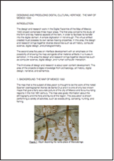
The design and research work in the Digital Facsimile of the Map of Mexico 1550 project comprises three major areas. The first area concerns the study of the form and key material aspects of the item, in order to facilitate its transfer into the digital domain. A simple digitization in not enough: The virtual artifact created must possess its own sense-making properties. In this area, the design and research brings together diverse disciplines such as art history, computer science, digital design, and photogrammetry.
Link:
Web version, include Antonella Sbrilli's comments
ImaNote: a Zoomable Web-Based Multi-User Image Viewing and Annotation Tool
Author:
Atte Timonen, Lily Díaz, Markku Reunanen
Language:
English
Year:
2007
Abstract:
We have created a tool called ImaNote (Image Annotation Notebook) for viewing, zooming and annotating arbitrary-sized images using a web browser. Multiple users can work with the tool simultaneously, being able to almost instantly see and edit each other’s modifications. In this paper, we describe the design, implementation and user interface of ImaNote focusing on issues arising from the web-based nature of the software as well as from its intended use as a tool for visualization and interaction with digital surrogates, facsimiles and replicas of cultural heritage objects.
Digital Narrative and Collaborative Design in the Chronicles and Legends of Mexico City
Author:
Lily Diaz
Language:
English
Year:
2005
Abstract:
This essay describes the process, combining collaborative design, pedagogy, and research, used in the creation of digital video narratives of the legends and chronicles of the historic center of Mexico City. These digital narratives are to be published as part of an information technology product, namely the Map of Mexico 1550 Digital Facsimile. The narratives were created by a group of students in the program in Interactive Design and the Universidad Iberoamericana de Ciudad de México.
A voice for the Map Of Mexico 1550
Author:
Lily Diaz
Language:
English
Year:
2004
Abstract:
The project proposes to create a Commentaries section to the Digital Facsimile of the Map of Mexico 1550. This is to be done by gathering a selection of Chronicles, Legends, and Oral Traditions of the Historic Center of Mexico City. The tasks involve documentation and recording of citizens narrating the Chronicles and Legends in, or close to, the spaces that they describe. Though many of these locations have changed through the passage of time, the objective is to capture the history and spirit of the place as it is contained in these stories. Once the narratives are gathered in digital video, they will be combined with still images of the city and inserted as another layer to the Digital Facsimile of the Map of Mexico 1550. The viewer will be able to browse through the Map depicting the colonial city while listening to these narratives.
The project proposes to complete these activities and publish the multimedia materials as an interactive installation and as a net-based work on the Internet. The timetable for completing the work is two months from the starting date.
Photogrammetric Reproduction of the map of Mexico 1550
Author:
M.Nuikka, Lily Diaz, H.Haggrén
Language:
English
Year:
2004
Abstract:
The aim of our research is to develop a method for producing 3D high-resolution photogrammetric reproductions of historical maps. As an example we have created a reproduction of the Map of Mexico from year 1550. It is one of the oldest extant maps of the Tenochtitlan, the ancient capital of the Aztec Empire, which was located on the site of present day Mexico City. The size of the map is 114 cm x 78 cm and it is painted on parchment, which has been curved during the years. Researchers are interested in the map because of the legends they could interpret from its texts and detailed pictures. The map is however out of reach in a closed glass cabinet in the University of Uppsala, Sweden. The requirements for the reproduction were that the curved surface of the parchment is taken into account and the resolution of the texture should be so good that also the little details of the map are distinguished. We created the reproduction using similar photogrammetric techniques as in terrain mapping, though the used camera and the implementation of measurement coordinate system were different than in traditional terrestrial projects. The most important advantage of the photogrammetric approach is the possibility to create accurate reproductions, which can be examined with high magnification.
Usability testing and the digital facsimile of Map of Mexico 1550
Author:
Lily Diaz Kommonen, Mariana Salgado
Language:
English
Year:
2003
Abstract:
This paper describes the usability test carried out as a part of the interface design to further develop the Digital Facsimile of Map of Mexico 1550. The working method used brought insights regarding the social and individual subjective experience involved in navigating an interactive piece. The work also triggered reflections related to user testing and experimental methods employed. It also defined the guidelines for the second version of the Digital Facsimile that is presented from May of 2003 at the Gropius Bau Museum in, Berlin, Germany.