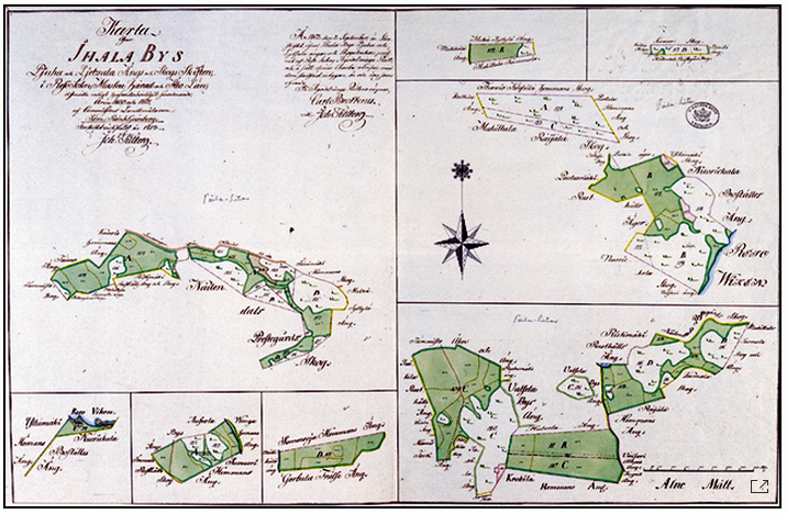

This map represents a great meadows area near Raisionlahti Bay which is mentioned already in some Middle-Age documents. In the 17th and 18th century dozens of Raisio farms and some farms of Naantali, Rusko, Maaria and Kaarina parish owned meadows there. Before the general parcelling, the meadows were, too, in open field system, a situation which caused enormous confusion. General parcelling was realized in Lietsala and Piuha in the 1780s. The forests were divided to individual farms. On the map, A stands for Mulli, B for Siiri, C for Knuuti and D for Konsa farm holdings of meadow and forest.
Sources:
Mäntylä 1965: 145-147.
Oja 1960 101-104.
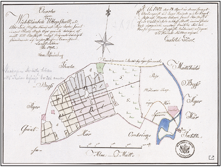
Vihtilänpyöli was a taxable outlying agricultural area, a separate piece of land which was cultivated by the inhabitants of Ihala village after 1584, having been before that property of Kajala farm of Kuloinen village. Vihtilänpyöli was perhaps a remainder of a farm that had become desolated in the Middle Ages and the lands had been taken into use by neighbouring farms. In 1803 Vihtilänpyöli was divided between Knuuti (Nuutila) and Siiri farms and a croft. The map shows the fields of the area both in open field system and general parcelling. East of the fields there was a hill covered by forest which was in the general parcelling owned partly by Knuutila and partly by the croft (N° 5 on the map). On the other side of the hill there were the miller's croft and the big water mill of Huhkonkoski Rapids on the opposite bank of Raisionjoki River.
Sources:
Oja 1960: 98, 99.
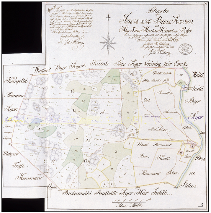
The «general parcelling» has been finished: the fields of a farm are no more divided into thin strips residing here and there. On the contrary, each farm has now 1 or 2 big field parcels and some smaller fields. Also the forest and meadow area west of the fields has now been parcelled into segments for the farms. On the map, A stands for Mulli, B for Siiri, C for Knuuti (Nuutila) and D for Konsa farm and their forest divisions, respectively. In the upper right corner of the map you can see the Huhkonkoski Rapids water mill (Reso Qwarn) and taxable outlying areas of Vihtilänpyöli (Wichtilänböle Utbys Skatts jord).
Mäntylä 1965: 137-144.